Just want to see the best? I've picked out twenty of my favourite image pairs from the collection.
Hoi Sham ParkUnknown date and July 2009 Probably my favourite set of all: aesthetically pleasing and captures the changing city skyline. The additional boulders have made lining the new shot up a problem - I'd love to know if HK Man took any at a slightly lower angle.
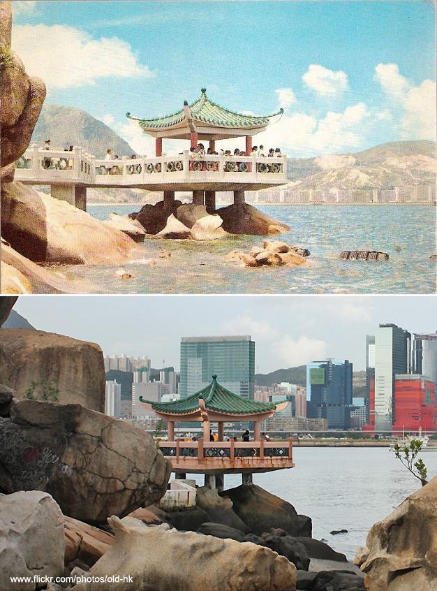
Probably my favourite set of all: aesthetically pleasing and captures the changing city skyline. The additional boulders have made lining the new shot up a problem - I'd love to know if HK Man took any at a slightly lower angle.
Sheung Wan, Junction of Des Voeux Road Central and Rumsey StreetPost-war and Nov 2010 This pair of images really captures the transformation of Hong Kong: the dramatic and total change in architecture, and the explosion of towers in the distance. But the much-beloved tram provides some continuity between the two images.
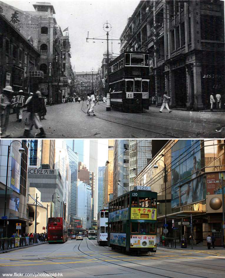
This pair of images really captures the transformation of Hong Kong: the dramatic and total change in architecture, and the explosion of towers in the distance. But the much-beloved tram provides some continuity between the two images.
Upper Albert Road and Albany Road1964 and Nov 2010 This set shows the intense three dimensionality that I love about Hong Kong. The red and white colour scheme of taxis visible in both images endures today, and inspired the colours of this website.
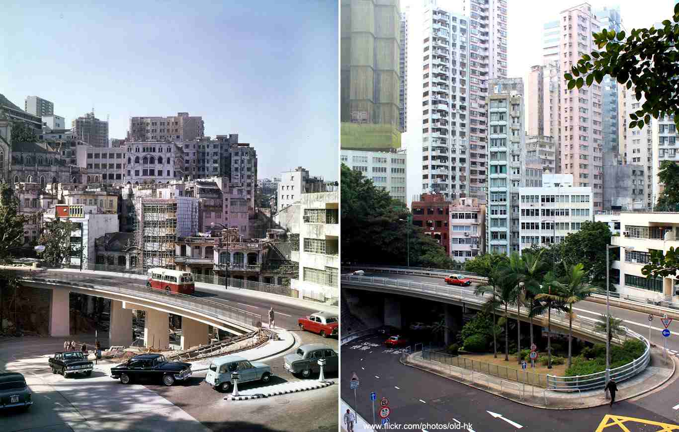
This set shows the intense three dimensionality that I love about Hong Kong. The red and white colour scheme of taxis visible in both images endures today, and inspired the colours of this website.
Kowloon Walled City, at the junction of Tung Tau Tsuen and Tai Shing roadsc.1970s and Dec 2008 This area of shops and housing on the left was part of Kowloon Walled City. The Walled City was an incredibly dense urban enclave that was essentially self-policing. A maze of alleyways between inter-connected high rise buildings, it was crammed with cheap housing and unregulated businesses. The site was finally cleared in 1994 and is now the home of a park. There's a brilliant book about it by photographer Greg Girard called City of Darkness.
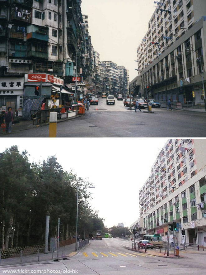
This area of shops and housing on the left was part of Kowloon Walled City. The Walled City was an incredibly dense urban enclave that was essentially self-policing. A maze of alleyways between inter-connected high rise buildings, it was crammed with cheap housing and unregulated businesses. The site was finally cleared in 1994 and is now the home of a park. There's a brilliant book about it by photographer Greg Girard called City of Darkness.
Wyndham Street and Wellington Street junctionc.1874 and Jan 2010 This is one of the oldest images in HK man's collection. The sign on the left is for the Hong Kong Photographic Rooms, a studio where customers could have portraits taken, or buy prints of scenes of Hong Kong. The original owner was an Emil Riisfeldt, who soon after left for a career in Australia. Unfortunately the negatives of his Hong Kong photography have not been found.
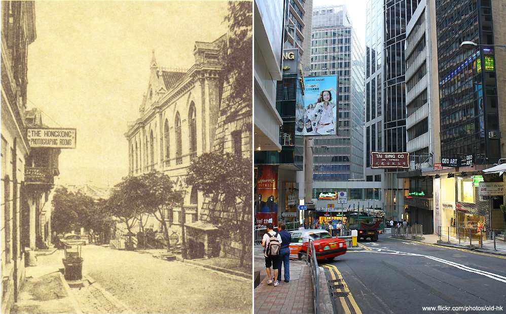
This is one of the oldest images in HK man's collection. The sign on the left is for the Hong Kong Photographic Rooms, a studio where customers could have portraits taken, or buy prints of scenes of Hong Kong. The original owner was an Emil Riisfeldt, who soon after left for a career in Australia. Unfortunately the negatives of his Hong Kong photography have not been found.
The Panorama Gardens apartment building, Robinson RoadUnknown date and Sept 2009 HK man called this collection '香港在消失ing': Hong Kong is disappearing, and lamented the loss of the many old buildings of the city. He felt that the city was losing its special character, and beginning to look like every other city. Certainly some of his collection make it hard to disagree.
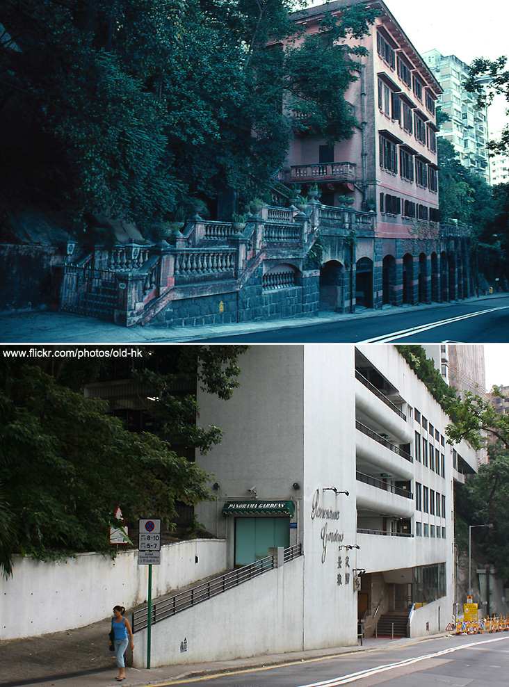
HK man called this collection '香港在消失ing': Hong Kong is disappearing, and lamented the loss of the many old buildings of the city. He felt that the city was losing its special character, and beginning to look like every other city. Certainly some of his collection make it hard to disagree.
The Central MarketUnknown date and Dec 2009 The old central market buildings was replaced in 1937 with the Bauhaus style building we can see here. It was then closed in 2003, to be destroyed to make room for high rise buildings, but protests won out and the building was granted protected heritage status. It's now undergoing redevelopment, though it's unclear what the future plan for the building is.
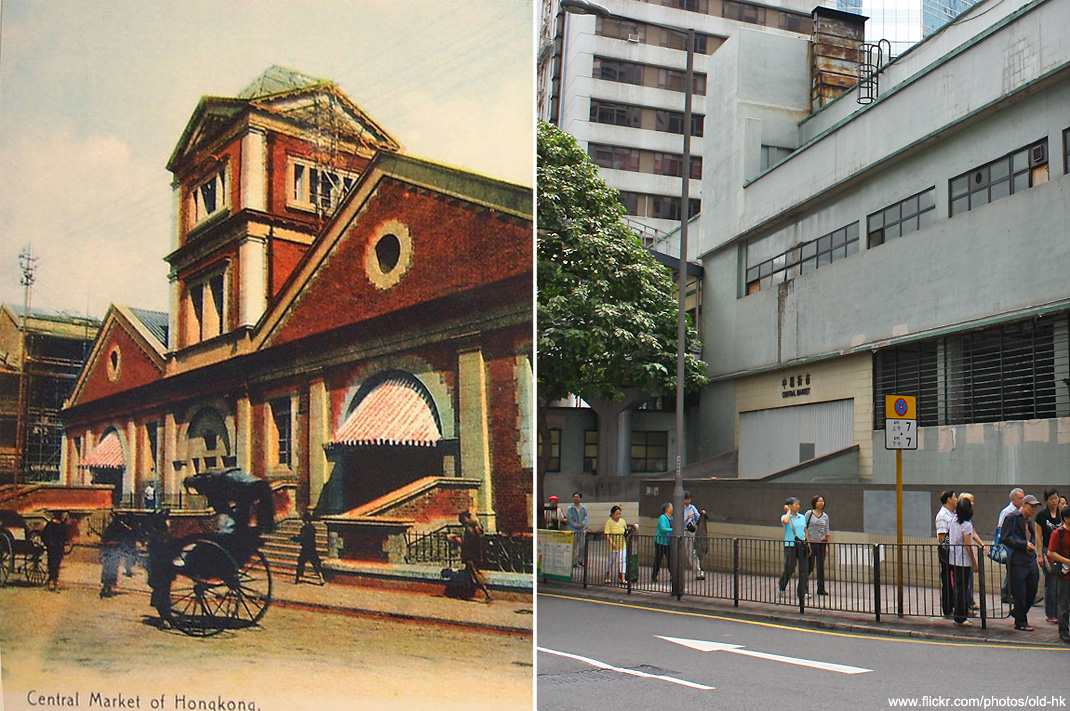
The old central market buildings was replaced in 1937 with the Bauhaus style building we can see here. It was then closed in 2003, to be destroyed to make room for high rise buildings, but protests won out and the building was granted protected heritage status. It's now undergoing redevelopment, though it's unclear what the future plan for the building is.
Price Edward Road, WestDate unknown and Oct 2010 Quite the dramatic contrast here. Note the church has survived the intervening years, and peeks out from behind the new apartment building.
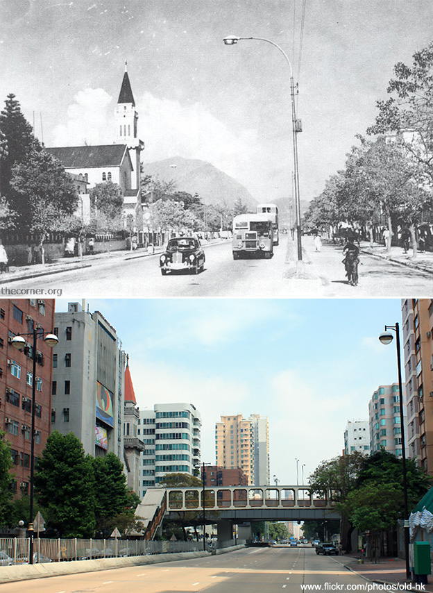
Quite the dramatic contrast here. Note the church has survived the intervening years, and peeks out from behind the new apartment building.
Kennedy Town, now the junction of Cadogan Street and Catchick StreetPossibly around 1920 and July 2009 Another complete transformation, with only the tram lines providing continuity between the two eras.
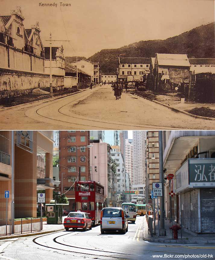
Another complete transformation, with only the tram lines providing continuity between the two eras.
The Peak Tower70s or 80s and August 2009 I love the science fiction styling of the original peak tram building. Thankfully they replaced it with something almost as unusual in shape.
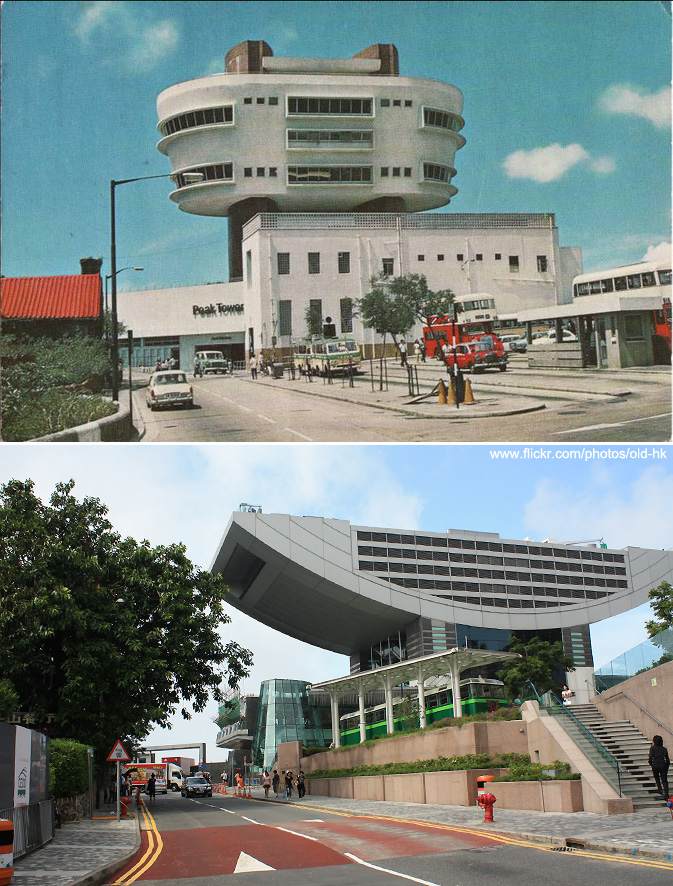
I love the science fiction styling of the original peak tram building. Thankfully they replaced it with something almost as unusual in shape.
The Peak Tram1890 and August 2009 An even older image of the tram. As an integrated part of the public transport system it also has the red and white branding.
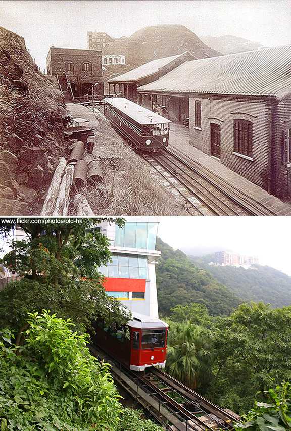
An even older image of the tram. As an integrated part of the public transport system it also has the red and white branding.
Ferry Street, 1972 and Jun 2011 An excellent example of land reclamation in the city. The people living in the apartment building must have been disappointed in the change of view. The building also as an interesting and distinctive lean.
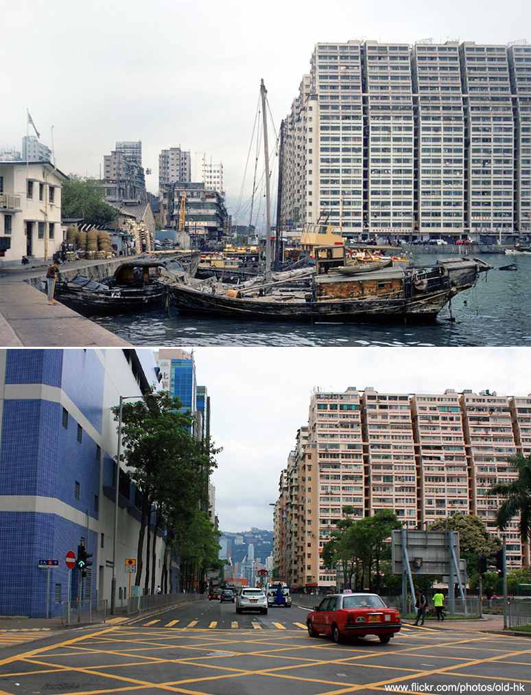
An excellent example of land reclamation in the city. The people living in the apartment building must have been disappointed in the change of view. The building also as an interesting and distinctive lean.
King's Road and Shipyard Lane, Quarry Bay1980 and Jan 2011 Another example of human reconfiguration of Hong Kong's landscape: the hill in the older image was completly removed in the 1980's, making way for the white apartment buildings in the newer photograph.
Another example of human reconfiguration of Hong Kong's landscape: the hill in the older image was completly removed in the 1980's, making way for the white apartment buildings in the newer photograph.
Star Ferry Bus Station, Tsim Sha Tsui1966 and May 2011 While the bus station remains the same, the skyline behind it has changed dramatically.
While the bus station remains the same, the skyline behind it has changed dramatically.
Wan Chai sports groundc.1964 and Nov 2009 A great image showing how the residential architecture of the city has changed.
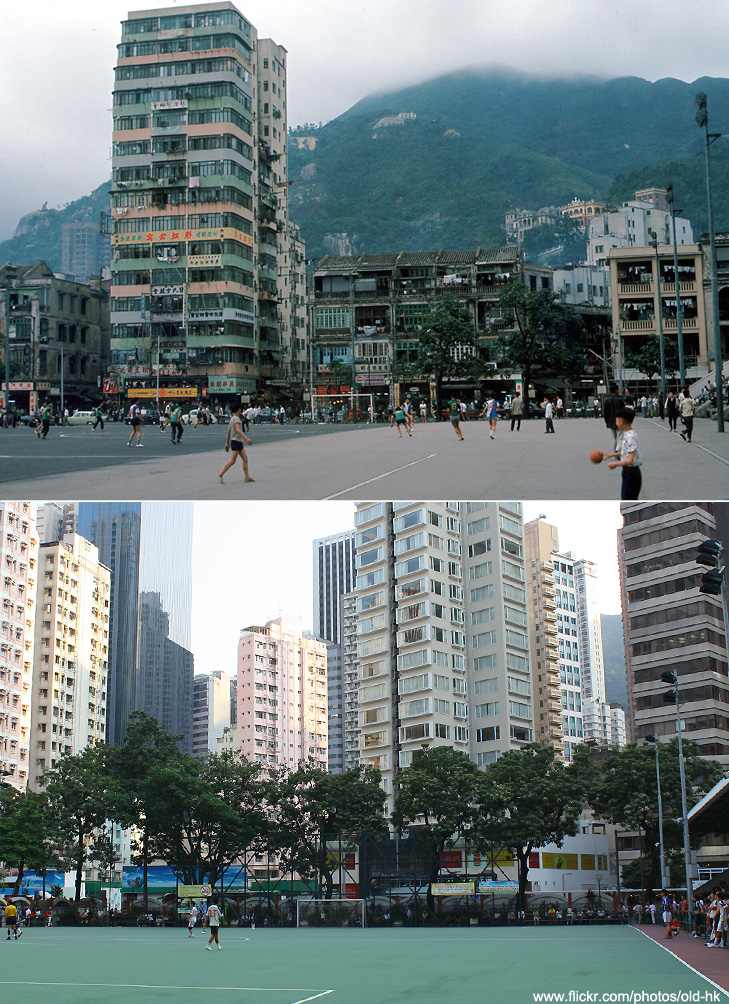
A great image showing how the residential architecture of the city has changed.
Square Street1960 and Apr 2010 HK Man also used stills from films - this colourful scene is taken from 1960's The World of Suzie Wong. The colour scheme of the building seems to have survived, perhaps coincidentally.
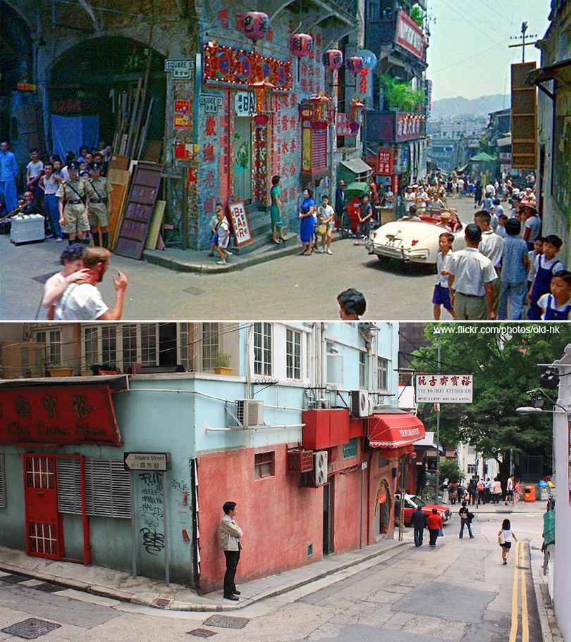
HK Man also used stills from films - this colourful scene is taken from 1960's The World of Suzie Wong. The colour scheme of the building seems to have survived, perhaps coincidentally.
Tsui Sing Lau PagodaUnknown date and Sept 2011 This is the Tsui Sing Lau Pagoda - the oldest surviving pagoda in Hong Kong.
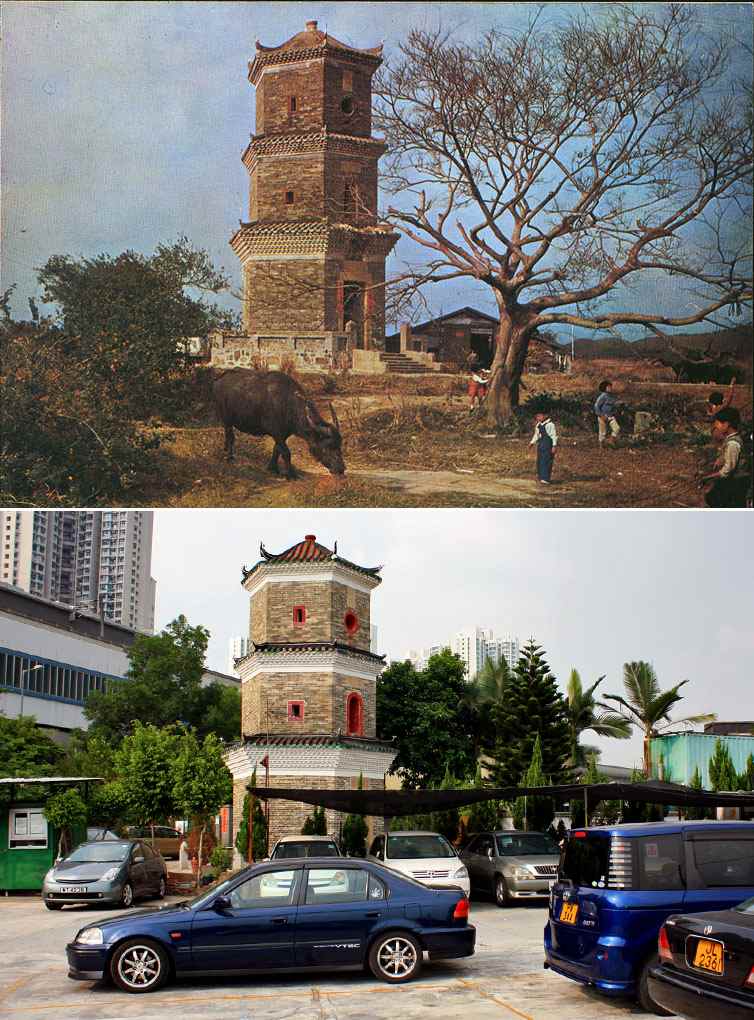
This is the Tsui Sing Lau Pagoda - the oldest surviving pagoda in Hong Kong.
Sha Tin Station1976 and Jul 2009 The first big renovation to Sha Tin was in 1980, preparing it for electric trains. A few years after that a large shopping centre was built on top of the station - Citylink Plaza.
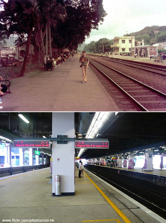
The first big renovation to Sha Tin was in 1980, preparing it for electric trains. A few years after that a large shopping centre was built on top of the station - Citylink Plaza.
Ngau Tau Kok Roadc.1956 and Dec 2008 The intervening 55 years have completely changed the atmosphere of the area of these two images. The sign on the right in the older image reads 'Proposed site for government primary school'.
The intervening 55 years have completely changed the atmosphere of the area of these two images. The sign on the right in the older image reads 'Proposed site for government primary school'.
Southern entrance to Tate's Cairn TunnelDate unknown and Jun 2009 Most of the collection is made up of street scenes, but there's also some great wide angle images like this. Most evident here is the transformation of the low rise housing into parkland, and the expansion of the high rise buildings. I'd be particularly fascinated to see this scene again in a few decades.
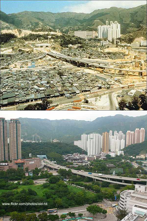
Most of the collection is made up of street scenes, but there's also some great wide angle images like this. Most evident here is the transformation of the low rise housing into parkland, and the expansion of the high rise buildings. I'd be particularly fascinated to see this scene again in a few decades.